May 28th, 2006
.
"Missed Church,
No Problem.
Sundays with Rev!
Hymn singing, fellowship, prayer, and a sermon.
All on the best Mtb trails in the country."

.
.
.
Ron, what you think about that for an RCO ride? I need a new chain so I might even take up an offering. .
.

Anyway, I have been taking a group of High Schoolers out for Mtb ride on Sunday afternoons. This past Sunday, May 28th, we decided to head upward to the Hot Spring Airport, about 4000 ft. The theme of the day was "Brokeback Mountian." Break'em before we get to the top.
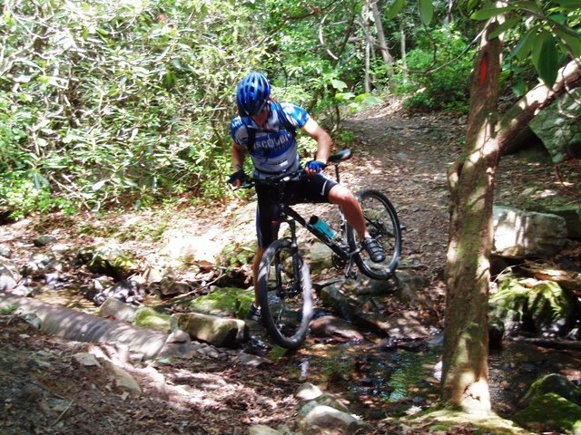 I didn't have my polar 720 so I don't really know how far we road or the feet climbed. We started out about 2 PM and finished around 8 PM. Started out in the parking lot across from the main office. Beards Gap Hollow left on Locust Gap right on Stony Run. The fun is about to begin. Stony run is a great climb. Pic left is the last creek crossing near the falls.
The awesome from from the Tuscarora Overlook. I pushed it a little up Stony Run to soften the legs of these greenhorns. At the top of Middle Mountain and Sandy Gap intersection. Ever taken the Sandy Gap trail down to 637 gravel road? I have on foot before but there are a lot of jumps. We took the Middle Mountain to 637. The trail is fast and tight. Some really tough switchbacks as you approach 637. Their legs are beginning to soften!
The last little dropoff before 637
How did he end up in the tree?


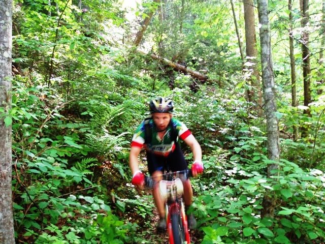

After reaching 637, we turned left and head uphill on the fireroad. There should be a trail about 2.5 miles on the right that takes you up to the runway. I haven't been on it before and we missed the trailhead. I think Warren has taken that path before, if so, send me a email on how to find it. Anyway, we peddled further to the top where the Sandy Gap trail crosses 637. We could go left and be back at the Middle Mountain intersection in about .5 miles. They wanted to see the airport, so we took a right up Sandy Gap. Things would fall apart on this trail. Lots of "breaking" would occur.
The trail was not that steep. Much like the average grade of Stony Run. There was only a few switchbacks. BUT THE TRAIL WAS TOUGH!. A little rocky and technical in some sections but the biggest hindrance was the bush. Man, when is the last time anyone trimmed the bushes up there. I felt like speedracer in need of a gizmo to trim the hedges as I road upward. The shrubs and trees overlapped the trail making the trail very hard to see and pedal through.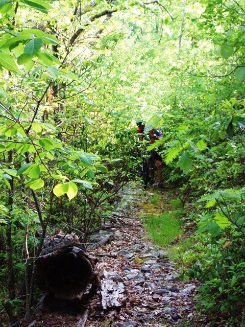
The brush was scratching, poking, blinding, and constantly getting in the drivetrain and wheels. I did an Xterra at Lake Sherando (blog it later) in which I hiked the bike for about an hr. Bikes are meant to be ridden. I hate hiking bikes so I was determined to ride through this stuff. I asked, "what would speedracer do?" I pushed the hedgetrim button, out popped the trimmers and I picked up the cadence. After about 20 minutes, I came to a slight clearing and stopped to see where the greenhorns were. They broke! I could hear them coming up the trail saying, "Did Rev ride through this stuff?" Finally from the brush, I see them pushing their bikes cursing me and mother nature.
The good news was we were about 1/2 there. The bad news was were were about 1/2 there. The map had this trail at 3.2 miles but it seemed much longer. Actually the trail was very rideable if it weren't for the brush. There was only a couple of times in which I came across a tree blocking the trail. There were a few rocky technical sections.
There are a lot of cool views and rock walls along the way. Near the top it flattens out to a meadow. I thought I might see a bear or dear lying in the sun. But no luck today. Finally, we pop out of the woods unto a fireroad leading to a hunting camp. Take a left, then go about 1/4 mile and you will be on the Skyline Homestead Airport road. Take a right and go about 3.5 miles and you will at the Airport. We arrived at the airport and I had no idea it was about 6:30. I took my map into the airport looking for some help to find the other trail near the runway. The map indicates that it is only about 1.5-2 miles long and ends up at the fireroad 637 near Douthat Road. The guy didn't know where it was and we didn't want to waste any time looking for it.
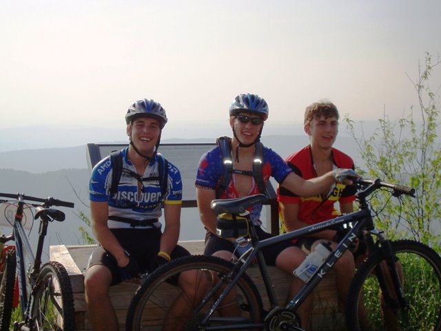
This is a great view along the skyline. Locals say you can see Snowshow WV (top right) on a clear day. We refueled our camelbaks and had a few snacks at the airport, then proceeded on the paved Skyline road back down to Clifton Forge. This is a fun descent!
 After some long straight descents and a few little climbs we made it to the intersection of Skyline Drive and the infamous 606. 606 is a brutal climb. From the interstate overpass in Clifton Forge, it is 7.1 miles with an average grade of around 8-9%. The only thing keeping this from being tougher than Wintergreen is that there is about 1 mile of a slight downhill/flat section along the way. The last 4 miles are killer. About 10 switchbacks with grades of 15-18%. Well, we were going down it this time.
At the 606 and Skyline intersections. Just remember to use the bathroom at the airport. There is NO DUMPING allowed here. The bottom of 606 now turns into Rose Ave in Clifton Forge. We were running out of daylight and the greenhorn's legs were gone a long time ago so we biked over to one of the guy's house and got a ride back to Douthat to get out vehicles. Nobody had a watch or computer so I don't know the numbers but I estimate we traveled about 38-40 miles with about 5500-6k feet of climbing. I do highly recommend the ride. The airport is a great place to refuel. Then find the trail that takes you back to Douthat. I'll keep you posted on that trail and other loops.
REV AND THE BROKEBACK BOYS 

1 comment:
That is one fantastic epic ride! YES!!! Let's have a ride up in Douthat this fall - camping, riding, eating!
Still need a chain?
Post a Comment